-40%
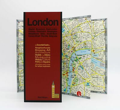
Red Maps London CURRENT EDITION - City Travel Guide
$ 5.25
- Description
- Size Guide
Description
Red Map London coversthe area from Hyde Park, Notting Hill, Paddington and Marylebone to Mayfair, Soho, Bloomsbury; east to The City and Shoreditch. To the south are Southwark, Knightsbridge, Belgravia, Chelsea, White Hall and Waterloo areas. There is also a special map for Queen Elizabeth II Olympic Park, Greenwich and Canary Wharf.
Attractions
in London to see include
Kensington Palace, Big Ben, Westminster Abbey, Buckingham Palace, St James's Park, Tower of London, Covent Garden Opera House, the Imperial War Museum,
the
Tate
and
Tate Modern,
the
V&A
and the
British Museum.
Where to shop in
London
is entertaining, so the Red Maps provides you with over 300 designer boutiques and shops on
Bond,
Sloan,
Jermyn Streets
and
Savile Row.
Map Size:
Open:
24x9.5 in/61x24cm
Closed:
4x9.5 in/10x24cm
For 18 years Red Maps have
provided travelers with curated lists to a city’s best hotels, shopping, cultural attractions, restaurants, and lifestyle.
