-40%
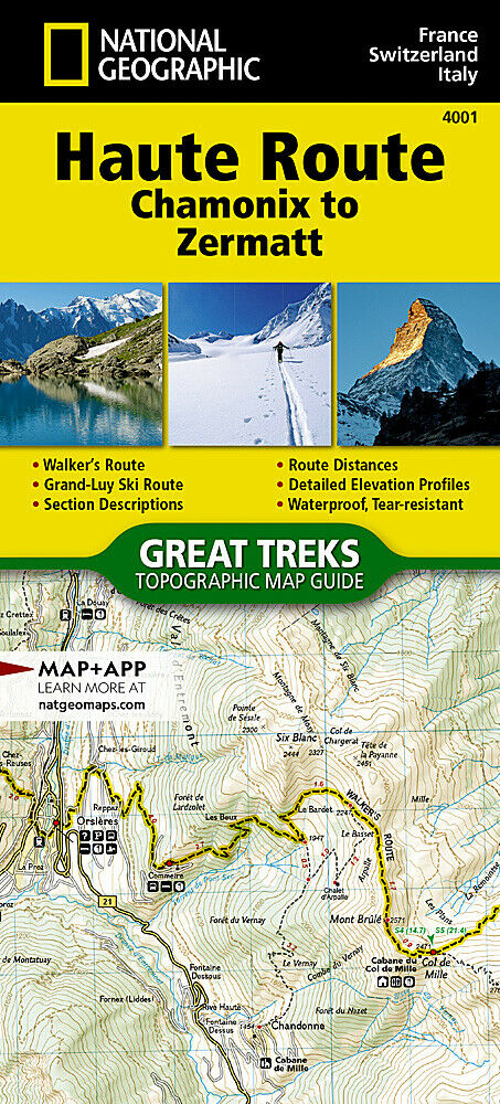
National Geographic Europe Haute Route Chamonix to Zermatt Topo Map Guide 4001
$ 7.33
- Description
- Size Guide
Description
BRAND NEW National Geographic Europe - Haute Route, Chamonix to Zermatt Topographic Map Guide.• Waterproof • Tear-Resistant • Topographic Maps
The Haute Route—aka the High Route or Mountaineers' Route—traverses the French and Swiss Alps. It was conceived as a summer mountaineering route in the mid-nineteenth century by members of the English Alpine Club. Though originally called "The High-Level Route" by members of the Alpine Club, in 1911, a group first successfully established a winter route from Bourg St. Pierre to Zermatt on skis and afterwards the name of the route was translated into French. As a result of their success, the French term stuck, and the journey gained a reputation amid skiers and ski mountaineers as a classic must-do winter/spring tour. There is also a non-technical Walker's Haute Route that has gained in popularity and become a classic in and of itself.
This Topographic Map Guide outlines two different variations of the Haute Route from Chamonix, France to Zermatt, Switzerland: one for hikers and one for skiers. The northernmost route or, Walker's Route, depicted on the map travels north from Chamonix and traverses through the Alps all the way to Zermatt. The ski route depicted on this map illustrates the Grand Lui variation, which is the longest and most technical route that eliminates the road links of the Verbier and Classic variations.
Though the term Haute Route has been widely used for many multi-day, hut-to-hut alpine tours, the "Chamonix–Zermatt Haute Route" remains the original. Thus, whether you choose to wear skis or hiking boots, the Haute Route is an adventure unlike any other.
More convenient and easier to use than folded maps, but just as compact and lightweight, National Geographic’s Topographic Map Guide booklets are printed on "Backcountry Tough" waterproof, tear-resistant paper with stainless steel staples. A full UTM grid is printed on the map to aid with GPS navigation.
Features:
Waterproof, tear-resistant paper
Accurate topography/terrain with clearly labeled details
Full UTM grid for GPS use
Includes regulations, permit info, and safety tips
Hiking trail and backcountry road guides
Route descriptions and mileages
Detailed topographic map with contour lines, elevations, and shaded relief
Water features with river mileage
Mountain bike routes with degree of difficulty
Campgrounds and campsites, scenic overlooks, and boat launch sites
Model: TI00004001
Scale: 1:50,000
Booklet Size: 4.25" x 9.38"
Weight: Approx. 3.4 oz each map
TIP:
For lower prices on our maps, check out our promotions (click the link above the picture). Here is the info: Purchase 2 - 3 maps and get 10% off, 4 or more will get you 15% off! This promo includes ALL of our maps. For example, purchase 2 Trails Illustrated maps, 1 Destination map, and 1 Adventure map (total of 4) and get 15% off!! Just put everything in your shopping cart and you will see the savings!
Requirements:
None.
You will receive:
1 National Geographic Topographic Map.
Retail packaging, shipped in a poly envelope. Shipping weight 4 oz.
If you have any questions or concerns, please contact us before or after the sale - we want you to be a happy customer!
Thanks for looking!
