-40%
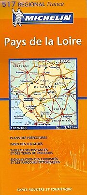
Michelin Map of Pays de la Loire, Michelin Map #517, French Edition
$ 2.61
- Description
- Size Guide
Description
Michelin Map of Pays de la Loire, Michelin Map #517, French EditionOne of the 21 map series of France Regional maps. Michelin's home turf, and perhaps no finer example of commercial cartography.
This
regional maps give a great overall picture of your route with practical road and travel information. Simple folding design, durable cardboard cover, multi-language legend, large-scale city maps, Clear, precise cartography, and ions pinpoint important travel information. Inset maps include: City maps of Nates, Angers, and Laval.
French Edition means that French is the primary language, but English is included.
Map is fully indexed, and comes with a driving time and distance chart.
When unfolded, map measures approx. 48" x 36", scale is 1:275,000
Map retails for $ 9.95, publication date: 2006, ISBN
978-2067106338
