-40%
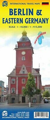
Map of Berlin and Eastern Germany, Germany, by ITMB
$ 6.3
- Description
- Size Guide
Description
Map of Berlin and Eastern Germany, Germany, by ITMBMap is printed on waterproof & tear resistant paper
Berlin on an indexed street map at 1:10,000 from ITMB, with the reverse showing an indexed road map of Eastern Germany at 1:425,000. Coverage of the map extends from Charlottenburg in the west to Alexander Platz in the eastern part of the city. The road map extends south to Erfurt, Gera and Chemnitz, and west to Wismar on the Baltic Coast.
From the Publisher: Main roads are shown in orange casing, secondary in pink, and local in white. Footprints demarcate major buildings and the map is covered with icons showing visitor attractions, hotels, and shopping areas. Rail lines and, of course, the S and U bahn lines are shown. To me, the strength of this map is the regional map of what used to be the DDR, or East Germany. After WWII Germany was divided into military zones that morphed into East and West Germany over time. Under Russian domination, East Germany was not open to travel for many years, so no travel maps were prepared. As communism collapsed and Germany was reunited, everyone had more important things to think about than a map for visitors, and authorities naturally wanted to "blur" the memories of decades of separation. As a result, there has never been a map of what used to be East Germany.
Map is brand new, and measures 39 x 27 inches. Copyright 2016, ISBN is
978-1771290807
